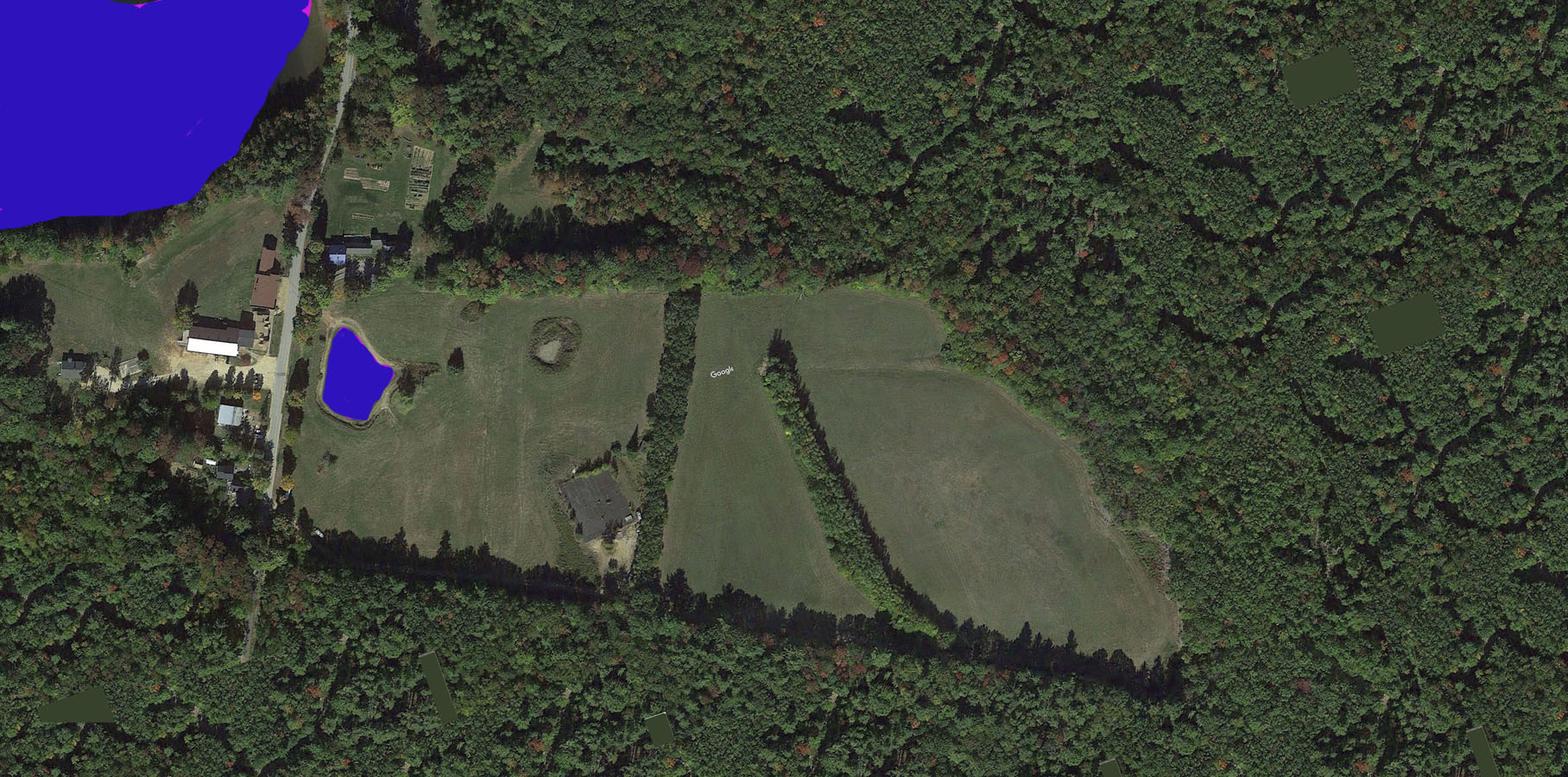
LSF bought the 115 acres in 2013. In this photo there is a cesspool visable in the lower field. That cesspool was used via Lake Shore Farm Inn for decades. Also in the lower field is visible the remains of a tennis court.
We bought the land from DGD Development of Northwood for $300,000.
DGD had planned to subdivide the land into about 50 lots. They were eventually turned down by the Town of Northwood. During their attempt at subdivision they had the 115 ares surveyed and created a detailed map of the property boundary.
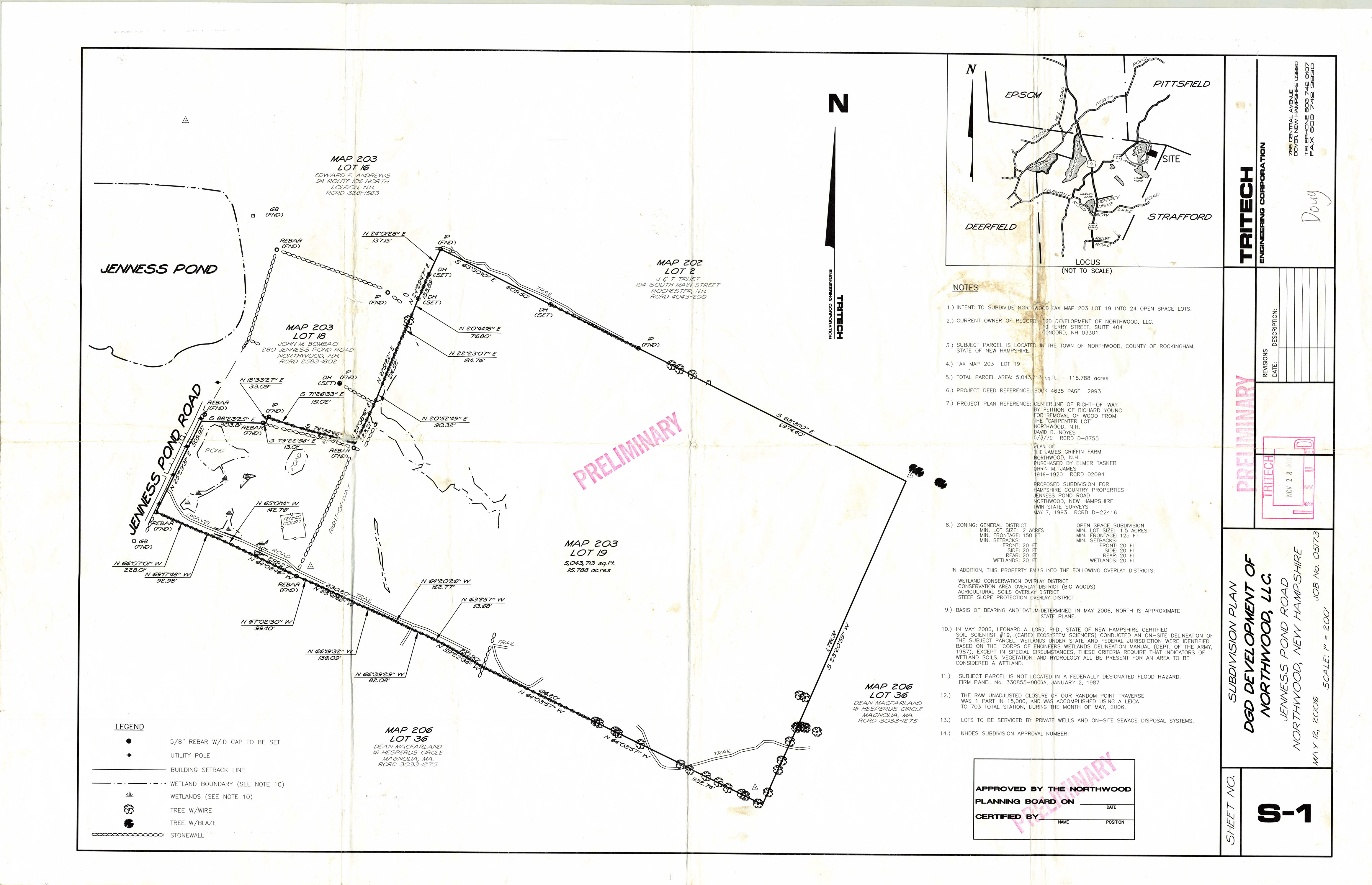
This map can be a great help when trying to identify the boundaries. In addition to indicatng where there are stone walls along the boundary, in many places it has a symbol of a "Tree With Wire". That implies that at one time there was a barbed wire fence along the boundary, probably to keep sheep enclosed, and various trees "encased the barded wire" as the trees grew larger and larger. These many years later, even though the barbed wire fence is not longer visible, remenants of it seem to be growing out of the centers of trees.]!QAS
In
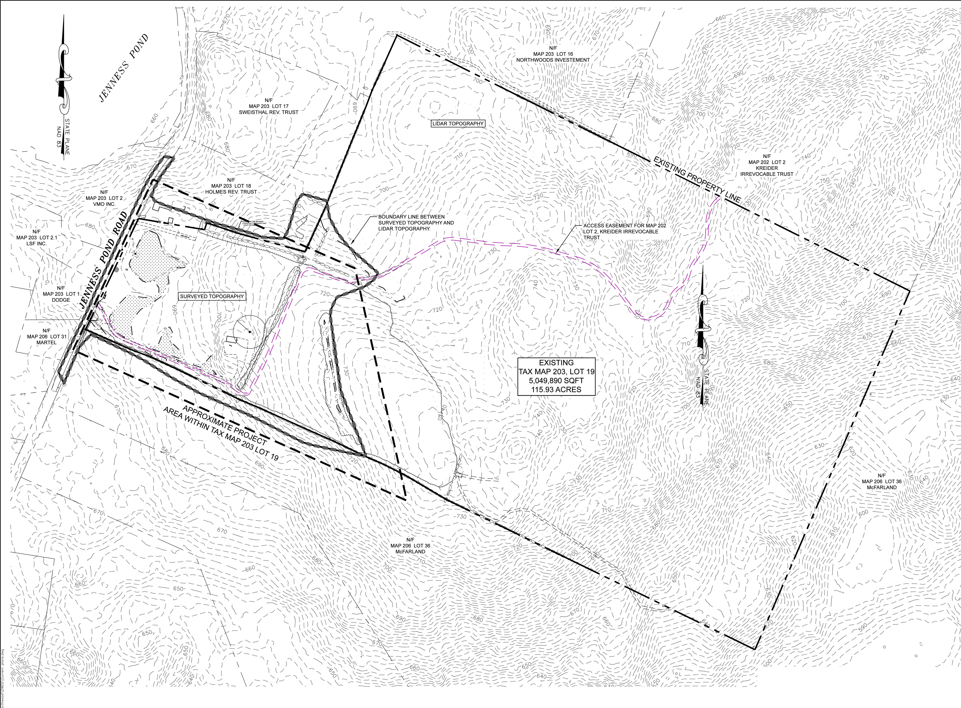
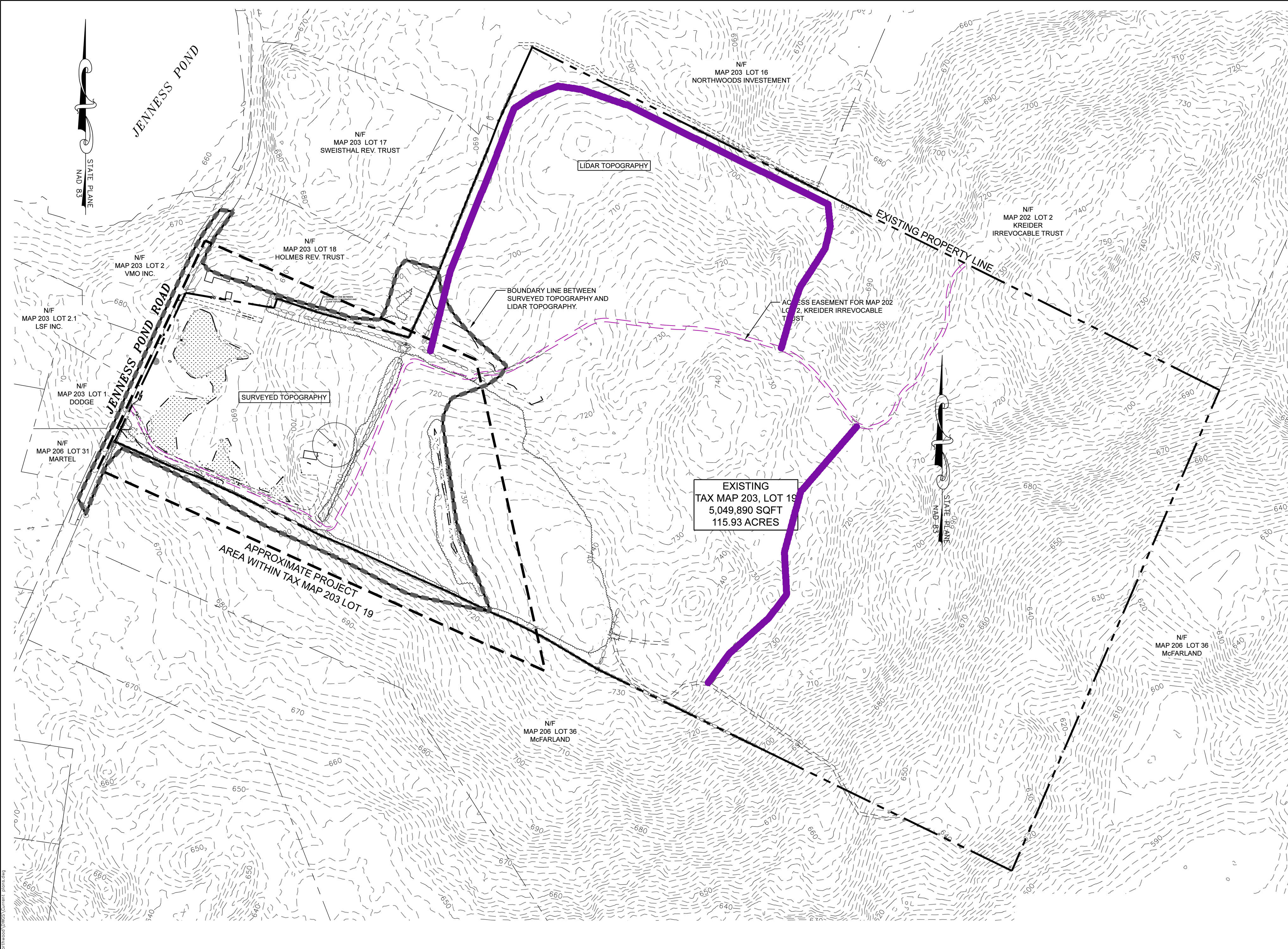
2024 we subdivided the 115 acres into 4 parcels so that family and friends could build there if desired. The following figures come from the subdivision document.
Page 2 shows elevaion contours. This map can be very helpful for planning where new roads/trails might be created as is illustrated in the second figure.
Page 4 shows details of the 4 lots and contains measurements that can be used for their deeds.
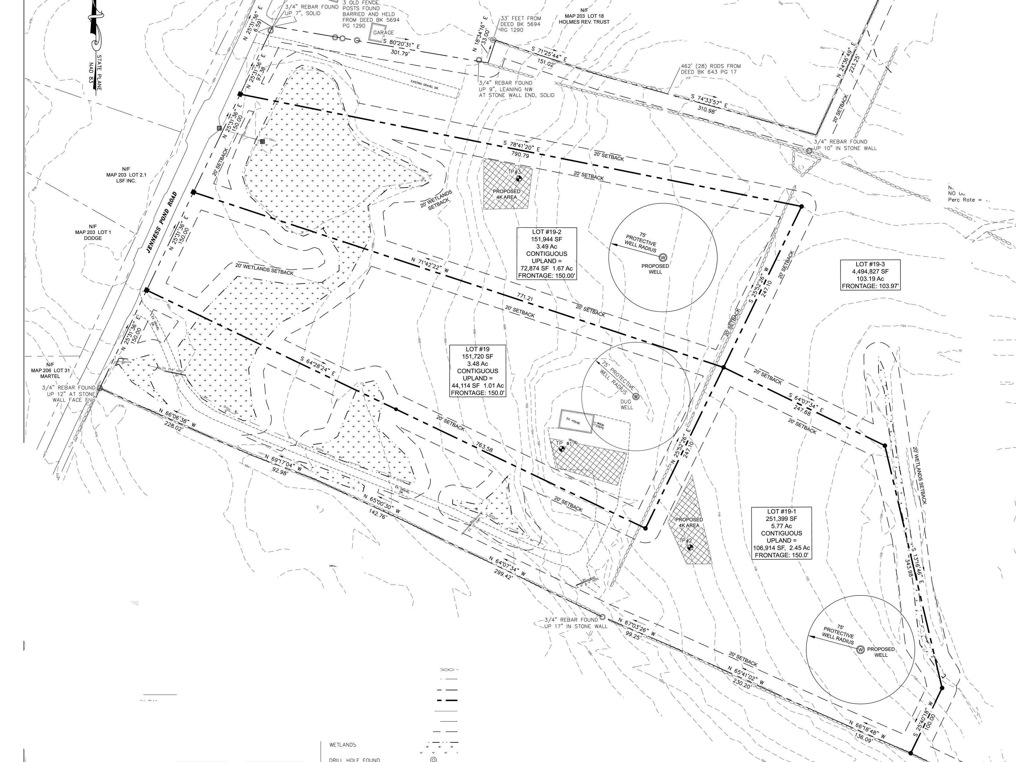
Rob's house is shown the above on Lot-19. Lot 19-1 contains the gravel road that is opposite Karen Hodge's property and has its buildable area beyond Rob's property. Lot 19-2 is to the north of Rob's lot - Dan and Kelly plan to build a house there. Lot 19-3 contains a new gravel road opposite from Lake Shore Farm Inn. This lot contains most of the acreage - 103 acres. The spectic and well locations shown above for Rob's Lot-19 indicate where they were created. The other septic locations for Lot 19-1 and Lot 19-2 indicate where test pits were dug to demonstrate feasablity; the locations are not binding but new tests would be need if they were moved. The well locations are not binding either. No test pit was dug for Lot 19-3 and one would be needed before it was declared a buildable lot.
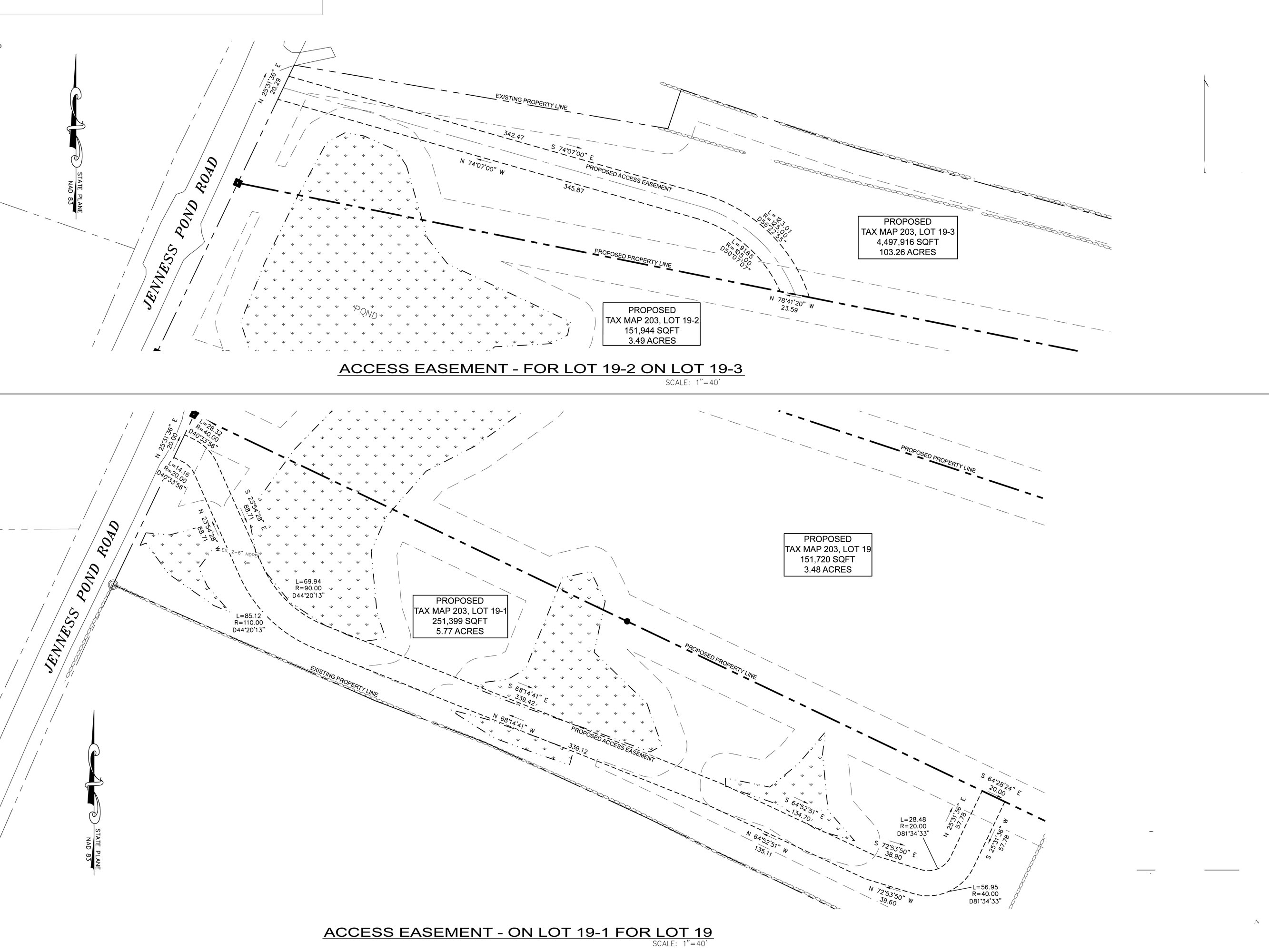
Page 6 shows details about the shared driveway for Rob's lot and the shared driveway on the other side of the property. The town required that the shared driveways be 20 ft wide up to the point where it is no longer shared. The deeds for each of the 4 lots should mention right-of-way easements for these shared driveways.
The following map was made via Google Earth Pro. I approximatley placed "thumbtacks" where boundary points were by iterating with distances and directions so that boundary angles were 90 degrees where called for and I also used the program's polygon feature so that the enclosed area was 0.18 SQ Miles = 115 Acres. The two trail locations were determined by using Google Maps on my phone and clicking on the "blue dot" at many locations as I walked a trail. The image was created by using Photoshop to merge 5 screenshots, thus there are some discontinuities if one zooms in.
